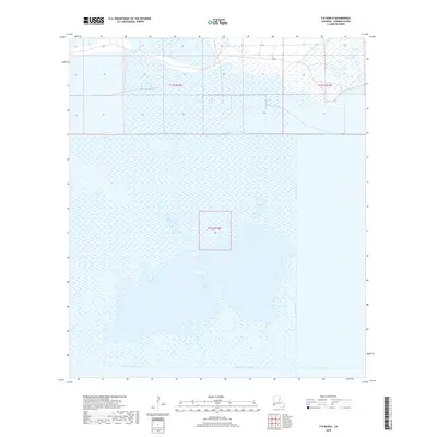
2018 Map of F-R Ranch
USGS Topo · Published 2018About this map
Five Lakes dominates this coastal wetland landscape in Cameron Parish, illustrating the complex hydrology of southwestern Louisiana. The area is defined by an extensive network of man-made waterways used for navigation and drainage, including the Burton-Sutton Canal, Starks North Canal, and the long north-south stretch of the Beach Canal. These engineering features intersect with natural water bodies such as Vincent Lake and Dore Lake, showing the modification of the marshlands for coastal industry and transport.
Find a feature on this map
12 named features on this map. Tap any name to fly to it.
Don’t see what you’re looking for? This feature index may not catch every label — zoom into the map to look around manually.
Map Details
Editions of this 2018 F-R Ranch Map
This is the sole edition of this map. No revisions or reprints were ever made.
Other maps of this area

1932 · Orange
USGS Topo · 1:62,500

1934 · Johnsons Bayou
USGS Topo · 1:24,000

1934 · Holly Beach
USGS Topo · 1:24,000

1934 · Peveto Beach
USGS Topo · 1:24,000

1934 · Greens Bayou
USGS Topo · 1:24,000

1934 · Browns Lake
USGS Topo · 1:24,000

1934 · Five Lakes
USGS Topo · 1:24,000

1935 · Peveto Beach
USGS Topo · 1:31,680

1935 · Five Lakes
USGS Topo · 1:31,680

1935 · Holly Beach
USGS Topo · 1:31,680