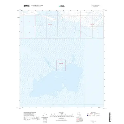
2020 Map of F-R Ranch
USGS Topo · Published 2020About this map
F-R Ranch stands as the primary namesake landmark in this corner of Cameron Parish, where the wet coastal prairie meets a complex network of industrial and natural waterways. The landscape is defined by the expansive Five Lakes system, a series of interconnected water bodies that dominate the southern half of the quadrangle. This 2020 survey reveals a coastal environment heavily modified by drainage and transport infrastructure, including the long reaches of the Starks North Canal, Starks Central Canal, and the Back Ridge Canal. The presence of Vincent Lake and Dore Lake further illustrates the low-lying, marshy character of the terrain. The grid of Public Land Survey System boundaries, such as t12s r12w, overlays these wetlands, indicating the historical division of the land even in areas dominated by water and ranching interests.
Find a feature on this map
12 named features on this map. Tap any name to fly to it.
Don’t see what you’re looking for? This feature index may not catch every label — zoom into the map to look around manually.
Map Details
Editions of this 2020 F-R Ranch Map
This is the sole edition of this map. No revisions or reprints were ever made.
Other maps of this area

1932 · Orange
USGS Topo · 1:62,500

1934 · Johnsons Bayou
USGS Topo · 1:24,000

1934 · Holly Beach
USGS Topo · 1:24,000

1934 · Peveto Beach
USGS Topo · 1:24,000

1934 · Greens Bayou
USGS Topo · 1:24,000

1934 · Browns Lake
USGS Topo · 1:24,000

1934 · Five Lakes
USGS Topo · 1:24,000

1935 · Peveto Beach
USGS Topo · 1:31,680

1935 · Five Lakes
USGS Topo · 1:31,680

1935 · Holly Beach
USGS Topo · 1:31,680