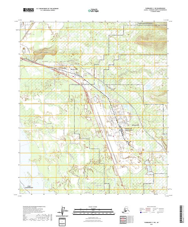
2021 Map of Fairbanks C-1 NE
USGS Topo · Published 2021About this map
Eielson AFB dominates the southeastern quadrant of this Alaska interior landscape, situated along the Richardson Highway corridor. The military installation is heavily developed with a complex network of residential streets such as Arctic Ave, Kodiak St, and Glacier Blvd, contrasted by the surrounding Tanana Valley wetlands. The Alaska Pipeline cuts diagonally through the center, running parallel to the highway and the winding path of Moose Cr. Water is a defining feature of the terrain, with extensive slough systems including Piledriver Slough and Twentyfive Mile Slough creating a braided hydrology typical of the region. Just north of the air base, the settlement of Moose Creek is established near the base of Moose Creek Bluff, while recreation spots like Bathing Beauty Pond and Polaris Lake sit within the base and community boundaries.
Find a feature on this map
69 named features on this map. Tap any name to fly to it.
Don’t see what you’re looking for? This feature index may not catch every label — zoom into the map to look around manually.
Map Details
Editions of this 2021 Fairbanks C-1 NE Map
This is the sole edition of this map. No revisions or reprints were ever made.
Other maps of this area

1949 · Fairbanks D-1
USGS Topo · 1:62,500

1949 · Fairbanks C-1
USGS Topo · 1:63,360

1949 · Big Delta C-6
USGS Topo · 1:63,360

1950 · Fairbanks
USGS Topo · 1:250,000

1950 · Big Delta
USGS Topo · 1:250,000

1950 · Big Delta D-6
USGS Topo · 1:63,360

1950 · Fairbanks C-1
USGS Topo · 1:63,360

1951 · Big Delta
USGS Topo · 1:250,000

1951 · Fairbanks
USGS Topo · 1:250,000

1952 · Big Delta C-6
USGS Topo · 1:63,360