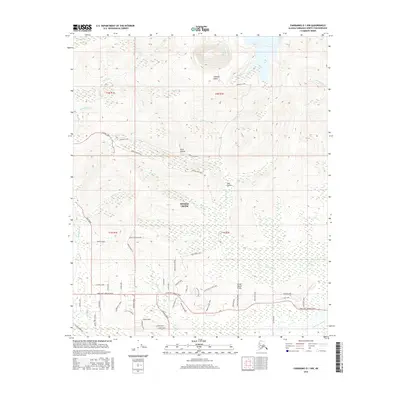
2016 Map of Fairbanks D-1 NW
USGS Topo · Published 2016About this map
Gilmore Dome anchors the high ground of this Interior Alaska landscape, overlooking a complex network of gold-rush era creeks and modern residential expansion. The settlement of Steele Creek serves as a focal point for a dense web of local roads, including Chena Hot Springs Road and Nordale Road, which connect various neighborhoods and homesteads. The terrain is defined by dramatic elevations and narrow drainages such as Dark Hollow and Gay Gulch. To the south, the Little Chena River meanders through lower elevations, joined by the Little Chena Prong. The infrastructure of the region is further evidenced by the Alaska Pipeline corridor cutting across the southwest corner, while historic paths like the Gilmore Trail and Smallwood Trail trace the ridges and valleys between Gilmore Cr and Steele Cr.
Find a feature on this map
66 named features on this map. Tap any name to fly to it.
Don’t see what you’re looking for? This feature index may not catch every label — zoom into the map to look around manually.
Map Details
Editions of this 2016 Fairbanks D-1 NW Map
This is the sole edition of this map. No revisions or reprints were ever made.
Other maps of this area

1945 · Livengood
USGS Topo · 1:250,000

1949 · Fairbanks D-1
USGS Topo · 1:62,500

1949 · Fairbanks D-2
USGS Topo · 1:62,500

1950 · Fairbanks
USGS Topo · 1:250,000

1951 · Fairbanks
USGS Topo · 1:250,000

1951 · Livengood
USGS Topo · 1:250,000

1952 · Fairbanks D-2
USGS Topo · 1:63,360
1952 · Fairbanks D-1
USGS Topo · 1:63,360

1952 · Fairbanks
USGS Topo · 1:250,000

1952 · Livengood A-2
USGS Topo · 1:63,360