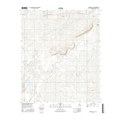
2016 Map of Fairbanks D-1 SE
USGS Topo · Published 2016About this map
The Chena River meanders across this Interior Alaska landscape, defining a complex network of waterways including the Chena Slough and Moose Creek Reservoir. During this period in the mid-2010s, the area near Pleasant Valley shows a established pattern of rural residential development branching off Chena Hot Springs Road. To the southwest, the Chena Lake recreation area and the Lakewood Airport serve as focal points for local transport and outdoor activity. The map provides a look at the intersection of high-latitude hydrology and settlement, where numerous creeks such as Potlatch Cr and Jenny M Cr feed into the primary river valley, and names like Laurance Road and Two Rivers Road mark the arterial routes through the Fairbanks North Star Borough.
Find a feature on this map
35 named features on this map. Tap any name to fly to it.
Don’t see what you’re looking for? This feature index may not catch every label — zoom into the map to look around manually.
Map Details
Editions of this 2016 Fairbanks D-1 SE Map
This is the sole edition of this map. No revisions or reprints were ever made.
Other maps of this area

1949 · Fairbanks D-1
USGS Topo · 1:62,500

1949 · Fairbanks C-1
USGS Topo · 1:63,360

1949 · Big Delta C-6
USGS Topo · 1:63,360

1950 · Fairbanks
USGS Topo · 1:250,000

1950 · Big Delta
USGS Topo · 1:250,000

1950 · Big Delta D-6
USGS Topo · 1:63,360

1950 · Fairbanks C-1
USGS Topo · 1:63,360

1951 · Big Delta
USGS Topo · 1:250,000

1951 · Fairbanks
USGS Topo · 1:250,000

1952 · Big Delta C-6
USGS Topo · 1:63,360