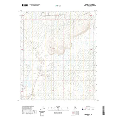
2021 Map of Fairbanks D-1 SE
USGS Topo · Published 2021About this map
The Chena River meanders through this landscape in the Fairbanks North Star Borough, creating a complex network of oxbows and wetlands. Near the southern edge, Chena Lake and the Lakewood Airport serve as central landmarks for local activity. The terrain is defined by low-lying drainages like Mullen Slough and Potlatch Cr, while residential development clusters along corridors such as Chena Hot Springs Road and Laurance Road East. Detailed road labeling, including family or descriptive names like Four Paws Lane and Bote Lane, provides a clear view of the modern settlement pattern as it interfaces with the interior's expansive waterways and marshes like North Chena Pond.
Find a feature on this map
34 named features on this map. Tap any name to fly to it.
Don’t see what you’re looking for? This feature index may not catch every label — zoom into the map to look around manually.
Map Details
Editions of this 2021 Fairbanks D-1 SE Map
This is the sole edition of this map. No revisions or reprints were ever made.
Other maps of this area

1949 · Fairbanks D-1
USGS Topo · 1:62,500

1949 · Fairbanks C-1
USGS Topo · 1:63,360

1949 · Big Delta C-6
USGS Topo · 1:63,360

1950 · Fairbanks
USGS Topo · 1:250,000

1950 · Big Delta
USGS Topo · 1:250,000

1950 · Big Delta D-6
USGS Topo · 1:63,360

1950 · Fairbanks C-1
USGS Topo · 1:63,360

1951 · Big Delta
USGS Topo · 1:250,000

1951 · Fairbanks
USGS Topo · 1:250,000

1952 · Big Delta C-6
USGS Topo · 1:63,360