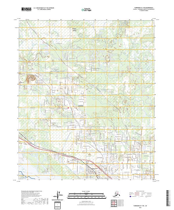
2024 Map of Fairbanks D-1 SW
USGS Topo · Published 2024About this map
The Tanana River and its intricate network of waterways, including Thirtymile Slough and Chena Slough, dominate this 2024 survey of the interior landscape southeast of Fairbanks. The community of North Pole and neighboring Highland Park are central to the region's development, connected by the heavy infrastructure of the Richardson Highway and the Alaska Pipeline. The area is notably characterized by its aviation history and private airfields, with several sites such as Dalrymple's Airport, Bradley Sky-Ranch Airport, and Lakewood Airport distributed across the flatlands between the river and the northern hills of Steele Creek. The presence of Fort Wainwright in the southwest corner anchors the map's military significance, while the winding course of the Chena River and Little Chena River suggests the persistent role of water in shaping the local transport and settlement patterns of this Alaskan corridor.
Find a feature on this map
37 named features on this map. Tap any name to fly to it.
Don’t see what you’re looking for? This feature index may not catch every label — zoom into the map to look around manually.
Map Details
Editions of this 2024 Fairbanks D-1 SW Map
This is the sole edition of this map. No revisions or reprints were ever made.
Other maps of this area

1949 · Fairbanks D-1
USGS Topo · 1:62,500

1949 · Fairbanks D-2
USGS Topo · 1:62,500

1949 · Fairbanks C-1
USGS Topo · 1:63,360

1949 · Fairbanks C-2
USGS Topo · 1:63,360

1950 · Fairbanks
USGS Topo · 1:250,000

1950 · Fairbanks C-1
USGS Topo · 1:63,360

1951 · Fairbanks
USGS Topo · 1:250,000

1952 · Fairbanks C-2
USGS Topo · 1:63,360

1952 · Fairbanks D-2
USGS Topo · 1:63,360
1952 · Fairbanks C-1
USGS Topo · 1:63,360