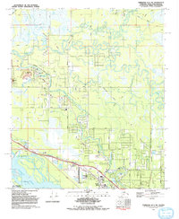
1992 Map of Fairbanks D-1 SW
USGS Topo · Published 1992About this map
The Chena River meanders through a complex network of oxbows and sloughs in this Fairbanks-area survey, illustrating the dynamic hydrology of the region in the early 1990s. The settlement of North Pole serves as a focal point in the southeast, situated near the Chena Slough and the Richardson Highway. This area reflects a multifaceted landscape where suburban growth at Highland Park and local landmarks like Bradley Sky-Ranch Airport meet significant infrastructure projects.
Find a feature on this map
27 named features on this map. Tap any name to fly to it.
Don’t see what you’re looking for? This feature index may not catch every label — zoom into the map to look around manually.
Map Details
Editions of this 1992 Fairbanks D-1 SW Map
This is the sole edition of this map. No revisions or reprints were ever made.
Other maps of this area

1949 · Fairbanks D-1
USGS Topo · 1:62,500

1949 · Fairbanks D-2
USGS Topo · 1:62,500

1949 · Fairbanks C-1
USGS Topo · 1:63,360

1949 · Fairbanks C-2
USGS Topo · 1:63,360

1950 · Fairbanks
USGS Topo · 1:250,000

1950 · Fairbanks C-1
USGS Topo · 1:63,360

1951 · Fairbanks
USGS Topo · 1:250,000

1952 · Fairbanks C-2
USGS Topo · 1:63,360

1952 · Fairbanks D-2
USGS Topo · 1:63,360
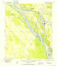
1952 · Fairbanks C-1
USGS Topo · 1:63,360