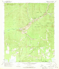
1966 Map of Fairbanks D-2 NE
USGS Topo · Published 1970About this map
Fox stands at the intersection of the Elliott Highway and Steese Highway, serving as a central point in this landscape of resource extraction and scientific infrastructure. The map reveals extensive Dredge Tailings along the valley floors, specifically following Goldstream Creek and its tributaries, marking the long-term impact of industrial mining on the terrain. Nearby, the Tungsten Hill Mine and several Gravel Pits indicate the diverse geological value of the area northeast of Fairbanks.
Find a feature on this map
53 named features on this map. Tap any name to fly to it.
Don’t see what you’re looking for? This feature index may not catch every label — zoom into the map to look around manually.
Map Details
Editions of this 1966 Fairbanks D-2 NE Map
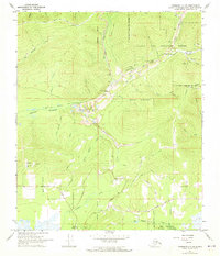
2 editions found
Other maps of this area

1945 · Livengood
USGS Topo · 1:250,000

1949 · Fairbanks D-1
USGS Topo · 1:62,500

1949 · Fairbanks D-2
USGS Topo · 1:62,500

1950 · Fairbanks
USGS Topo · 1:250,000

1951 · Fairbanks
USGS Topo · 1:250,000

1951 · Livengood
USGS Topo · 1:250,000

1952 · Fairbanks D-2
USGS Topo · 1:63,360
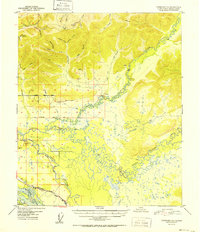
1952 · Fairbanks D-1
USGS Topo · 1:63,360

1952 · Fairbanks
USGS Topo · 1:250,000

1952 · Livengood A-2
USGS Topo · 1:63,360