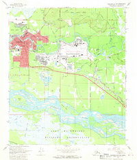
1966 Map of Fairbanks D-2 SE
USGS Topo · Published 1970About this map
The Chena River carves a winding path through the heart of Fairbanks, anchoring a landscape defined by rapid mid-century expansion and heavy military presence. The sprawling Fort Wainwright Military Reservation dominates the central and eastern portions of the map, featuring an extensive grid of service roads, athletic fields, and a prominent airfield. The integration of military and civilian life is evident in the cluster of institutions like the Heliport Hospital and several schools, including Hunter Sch and Lathrop High Sch, which serve the growing residential districts of Lemeta and Garden Island.
Find a feature on this map
58 named features on this map. Tap any name to fly to it.
Don’t see what you’re looking for? This feature index may not catch every label — zoom into the map to look around manually.
Map Details
Editions of this 1966 Fairbanks D-2 SE Map
2 editions found
Other maps of this area

1949 · Fairbanks D-1
USGS Topo · 1:62,500

1949 · Fairbanks D-2
USGS Topo · 1:62,500

1949 · Fairbanks C-1
USGS Topo · 1:63,360

1949 · Fairbanks C-2
USGS Topo · 1:63,360

1950 · Fairbanks
USGS Topo · 1:250,000

1950 · Fairbanks C-1
USGS Topo · 1:63,360

1951 · Fairbanks
USGS Topo · 1:250,000

1952 · Fairbanks C-2
USGS Topo · 1:63,360

1952 · Fairbanks D-2
USGS Topo · 1:63,360
1952 · Fairbanks C-1
USGS Topo · 1:63,360
Featured Places
- Fairbanks, AK
- Lemeta, Fairbanks
- Slaterville, Fairbanks
- Hamilton Acres, Fairbanks
- Fairbanks North Star, AK