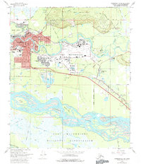
1966 Map of Fairbanks D-2 SE
USGS Topo · Published 1977About this map
Fairbanks sits at a critical junction of river and rail in the mid-1960s, its urban grid tightly packed between the Chena River and the sweeping curve of the Alaska Railroad. The map captures a transitional landscape where the town’s civic core—marked by institutions like St Josephs Hospital and Monroe High Sch—gives way to the expansive infrastructure of the Fort Wainwright military complex. This installation, formerly including the Ladd W Base and Ladd E Base, dominates the central portion of the survey, complete with its own schools and heliport.
Find a feature on this map
51 named features on this map. Tap any name to fly to it.
Don’t see what you’re looking for? This feature index may not catch every label — zoom into the map to look around manually.
Map Details
Editions of this 1966 Fairbanks D-2 SE Map
2 editions found
Other maps of this area

1949 · Fairbanks D-1
USGS Topo · 1:62,500

1949 · Fairbanks D-2
USGS Topo · 1:62,500

1949 · Fairbanks C-1
USGS Topo · 1:63,360

1949 · Fairbanks C-2
USGS Topo · 1:63,360

1950 · Fairbanks
USGS Topo · 1:250,000

1950 · Fairbanks C-1
USGS Topo · 1:63,360

1951 · Fairbanks
USGS Topo · 1:250,000

1952 · Fairbanks C-2
USGS Topo · 1:63,360

1952 · Fairbanks D-2
USGS Topo · 1:63,360
1952 · Fairbanks C-1
USGS Topo · 1:63,360
Featured Places
- Fairbanks, AK
- Lemeta, Fairbanks
- Slaterville, Fairbanks
- Hamilton Acres, Fairbanks
- Fairbanks North Star, AK