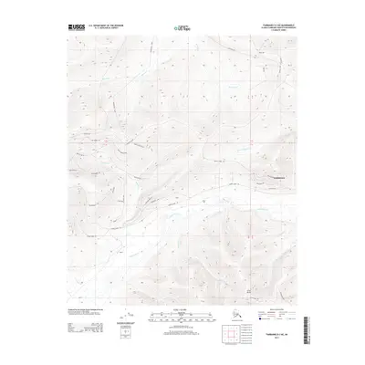
2013 Map of Fairbanks D-3 NE
USGS Topo · Published 2013About this map
Ester Dome anchors the southern portion of this interior Alaskan landscape, overseeing a complex network of creeks and rising ridge-lines north of Fairbanks. The settlement pattern here is dictated by the high-latitude terrain, with residential clusters like Goldstream and Martin positioned near the lifeblood of Goldstream Cr. The infrastructure is a mixture of established routes and evocative local names, where Murphy Dome Rd and Ester Dome Rd traverse the upland areas between drainage basins. Tributaries such as Spinach Cr, Nugget Cr, and Little Nugget Cr carve through the hills, illustrating the drainage patterns that historically supported mining and prospecting in this region. This modern survey captures the persistence of the Saulich area and the expansion of rural residential development along roads like Rocky Mountain Rd and Smokey Mountain Rd.
Find a feature on this map
46 named features on this map. Tap any name to fly to it.
Don’t see what you’re looking for? This feature index may not catch every label — zoom into the map to look around manually.
Map Details
Editions of this 2013 Fairbanks D-3 NE Map
This is the sole edition of this map. No revisions or reprints were ever made.
Other maps of this area

1945 · Livengood
USGS Topo · 1:250,000

1949 · Fairbanks D-2
USGS Topo · 1:62,500

1949 · Fairbanks D-3
USGS Topo · 1:63,360

1950 · Fairbanks
USGS Topo · 1:250,000

1950 · Fairbanks D-3
USGS Topo · 1:63,360

1951 · Fairbanks
USGS Topo · 1:250,000

1951 · Livengood
USGS Topo · 1:250,000

1952 · Fairbanks D-2
USGS Topo · 1:63,360

1952 · Fairbanks D-3
USGS Topo · 1:63,360

1952 · Fairbanks
USGS Topo · 1:250,000