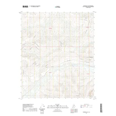
2021 Map of Fairbanks D-3 NE
USGS Topo · Published 2021About this map
Goldstream and Ester Dome anchor this rugged subarctic landscape north of Fairbanks, where the drainage patterns of Goldstream Creek and its many tributaries like Little Nugget Creek define the local topography. This 2021 survey illustrates a region shaped by its road network, showing a distinct transition from the residential street grids of Goldstream—including Darling Avenue and McCall Street—to the winding ridge-top routes of Old Murphy Dome Road and Murphy Dome Road. The map provides an exceptionally detailed view of the modern infrastructure serving these upland settlements, tracing dozens of named local roads and trails such as Teslin Trail and Perfect Perch Drive as they navigate the elevations between Murphy Creek and Sheep Creek.
Find a feature on this map
50 named features on this map. Tap any name to fly to it.
Don’t see what you’re looking for? This feature index may not catch every label — zoom into the map to look around manually.
Map Details
Editions of this 2021 Fairbanks D-3 NE Map
This is the sole edition of this map. No revisions or reprints were ever made.
Other maps of this area

1945 · Livengood
USGS Topo · 1:250,000

1949 · Fairbanks D-2
USGS Topo · 1:62,500

1949 · Fairbanks D-3
USGS Topo · 1:63,360

1950 · Fairbanks
USGS Topo · 1:250,000

1950 · Fairbanks D-3
USGS Topo · 1:63,360

1951 · Fairbanks
USGS Topo · 1:250,000

1951 · Livengood
USGS Topo · 1:250,000

1952 · Fairbanks D-2
USGS Topo · 1:63,360

1952 · Fairbanks D-3
USGS Topo · 1:63,360

1952 · Fairbanks
USGS Topo · 1:250,000