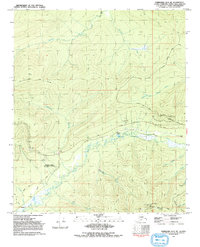
1992 Map of Fairbanks D-3 NE
USGS Topo · Published 1992About this map
Murphy Dome Air Force Station dominates the high ground in this subarctic landscape north of Fairbanks, situated among a network of communication facilities and access roads. The interior terrain is defined by prominent peaks like Murphy Dome and Ester Dome, the latter featuring an Observatory and multiple Radio Towers. Waterways such as the meandering Goldstream Creek and Moose Creek carve through the valleys, illustrating the complex drainage patterns of the Alaskan interior. Evidence of small-scale infrastructure and mining history appears near the rail-aligned settlement of Saulich and the Dome Spur, while a Winter Trail and the Old Murphy Dome Road suggest the evolving transportation routes used to navigate this environment during the late twentieth century.
Find a feature on this map
31 named features on this map. Tap any name to fly to it.
Don’t see what you’re looking for? This feature index may not catch every label — zoom into the map to look around manually.
Map Details
Editions of this 1992 Fairbanks D-3 NE Map
This is the sole edition of this map. No revisions or reprints were ever made.
Other maps of this area

1945 · Livengood
USGS Topo · 1:250,000

1949 · Fairbanks D-2
USGS Topo · 1:62,500

1949 · Fairbanks D-3
USGS Topo · 1:63,360

1950 · Fairbanks
USGS Topo · 1:250,000

1950 · Fairbanks D-3
USGS Topo · 1:63,360

1951 · Fairbanks
USGS Topo · 1:250,000

1951 · Livengood
USGS Topo · 1:250,000

1952 · Fairbanks D-2
USGS Topo · 1:63,360

1952 · Fairbanks D-3
USGS Topo · 1:63,360

1952 · Fairbanks
USGS Topo · 1:250,000