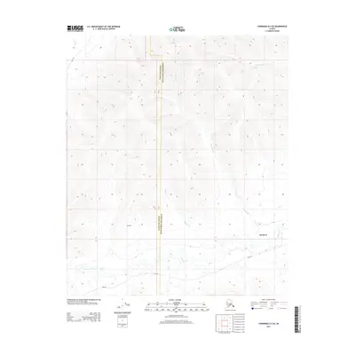
2013 Map of Fairbanks D-4 SE
USGS Topo · Published 2013About this map
Standard and the nearby settlement of California sit at the southern edge of the high Interior hills, marking a transition into the wetland-rich valley of Goldstream Cr. The landscape is defined by its drainage network, with the headwaters of Standard Cr, Glacier Cr, and Left-Fork Cache Cr cutting through the upland topography. These streams flow south and west toward the complex lowlands that characterize the region north of the Tanana River. Human passage through this terrain is primarily facilitated by the historic Sled Rd, which skirts the base of the hills, providing a vital connection through the muskeg and valley floor. The boundary between Yukon-Koyukuk and Fairbanks North Star boroughs bisects the quadrangle, reflecting the administrative divisions in this part of Alaska where wilderness and sparse settlement meet.
Find a feature on this map
8 named features on this map. Tap any name to fly to it.
Don’t see what you’re looking for? This feature index may not catch every label — zoom into the map to look around manually.
Map Details
Editions of this 2013 Fairbanks D-4 SE Map
This is the sole edition of this map. No revisions or reprints were ever made.
Other maps of this area

1949 · Fairbanks D-3
USGS Topo · 1:63,360

1949 · Fairbanks D-4
USGS Topo · 1:63,360

1950 · Fairbanks
USGS Topo · 1:250,000

1950 · Fairbanks C-3
USGS Topo · 1:63,360

1950 · Fairbanks C-4
USGS Topo · 1:63,360

1950 · Fairbanks D-3
USGS Topo · 1:63,360

1951 · Fairbanks
USGS Topo · 1:250,000

1952 · Fairbanks C-4
USGS Topo · 1:63,360

1952 · Fairbanks D-3
USGS Topo · 1:63,360

1952 · Fairbanks D-4
USGS Topo · 1:63,360