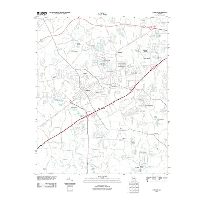
2011 Map of Fairburn
USGS Topo · Published 2011About this map
Union City and Fairburn serve as the primary hubs for this residential and suburban landscape just south of the greater metropolitan area. The 2011 survey reveals a complex network of established neighborhoods such as Shannon Villas, Suffolk Downs, and Melanie Manor, interspersed with numerous small lakes and reservoirs. Significant water bodies like Koweta Lake and Lake Frances are managed by named infrastructure such as the Lake Frances Dam and Arnolds Lake Dam. Genealogical interest is found in the scattered historic burial grounds, including Eason Cemetery, The Rock Cemetery, and Stephens Cemetery. The map also captures institutions like the Christian City Childrens Home and transit-oriented developments along Oakley Industrial Blvd, illustrating the continued transition of this corner of Fulton County from rural community to a built-out suburban corridor.
Find a feature on this map
131 named features on this map. Tap any name to fly to it.
Don’t see what you’re looking for? This feature index may not catch every label — zoom into the map to look around manually.
Map Details
Editions of this 2011 Fairburn Map
This is the sole edition of this map. No revisions or reprints were ever made.
Other maps of this area

1888 · Atlanta
USGS Topo · 1:125,000

1890 · Atlanta
USGS Topo · 1:125,000

1891 · Marietta
USGS Topo · 1:125,000

1892 · Atlanta
USGS Topo · 1:125,000

1895 · Atlanta
USGS Topo · 1:125,000

1895 · Marietta
USGS Topo · 1:125,000

1897 · Marietta
USGS Topo · 1:125,000

1901 · Marietta
USGS Topo · 1:125,000

1953 · Atlanta
USGS Topo · 1:250,000

1954 · Palmetto
USGS Topo · 1:24,000