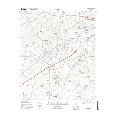
2014 Map of Fairburn
USGS Topo · Published 2014About this map
Union City and Fairburn dominate this suburban corridor south of Atlanta, where early 21st-century residential developments like Morning Creek Estates and Rosegate Manor intermingle with established historical markers. The map captures the dense network of roadways, including the S Fulton Pky and Oakley Industrial Blvd, which drive the region's modern commerce. Amidst this growth, local heritage is preserved at Eason Cem and The Rock Cem, while the Georgia Military College-Atlanta Campus serves as a key institutional landmark.
Find a feature on this map
73 named features on this map. Tap any name to fly to it.
Don’t see what you’re looking for? This feature index may not catch every label — zoom into the map to look around manually.
Map Details
Editions of this 2014 Fairburn Map
This is the sole edition of this map. No revisions or reprints were ever made.
Other maps of this area

1888 · Atlanta
USGS Topo · 1:125,000

1890 · Atlanta
USGS Topo · 1:125,000

1891 · Marietta
USGS Topo · 1:125,000

1892 · Atlanta
USGS Topo · 1:125,000

1895 · Atlanta
USGS Topo · 1:125,000

1895 · Marietta
USGS Topo · 1:125,000

1897 · Marietta
USGS Topo · 1:125,000

1901 · Marietta
USGS Topo · 1:125,000

1953 · Atlanta
USGS Topo · 1:250,000

1954 · Palmetto
USGS Topo · 1:24,000