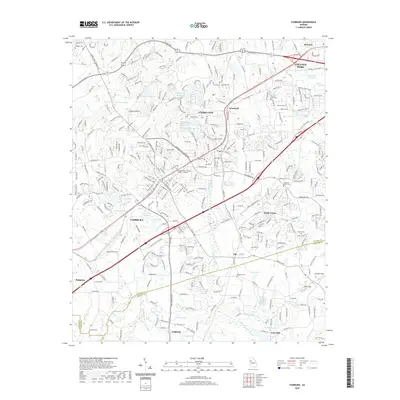
2020 Map of Fairburn
USGS Topo · Published 2020About this map
Union City and Fairburn anchor this suburban corridor southwest of Atlanta, showing a landscape defined by the intersection of traditional settlements and modern logistical expansion. The map details the transition between dense residential zones in College Park and the industrial hubs along Oakley Industrial Blvd and the Industrial Dr sector. Amidst this development, numerous local landmarks remain preserved, including the Georgia Military College Fairburn Campus and a high concentration of community burial grounds such as Forest Lawn Cem, Harmony Grove Cem, and the uniquely named The Rock Cem.
Find a feature on this map
63 named features on this map. Tap any name to fly to it.
Don’t see what you’re looking for? This feature index may not catch every label — zoom into the map to look around manually.
Map Details
Editions of this 2020 Fairburn Map
This is the sole edition of this map. No revisions or reprints were ever made.
Other maps of this area

1888 · Atlanta
USGS Topo · 1:125,000

1890 · Atlanta
USGS Topo · 1:125,000

1891 · Marietta
USGS Topo · 1:125,000

1892 · Atlanta
USGS Topo · 1:125,000

1895 · Atlanta
USGS Topo · 1:125,000

1895 · Marietta
USGS Topo · 1:125,000

1897 · Marietta
USGS Topo · 1:125,000

1901 · Marietta
USGS Topo · 1:125,000

1953 · Atlanta
USGS Topo · 1:250,000

1954 · Palmetto
USGS Topo · 1:24,000