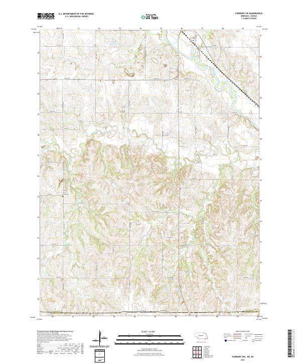
2021 Map of Fairbury SW
USGS Topo · Published 2021About this map
Silver Creek Cem sits in the rolling uplands of Jefferson County, Nebraska, marking a quiet point of local genealogy just north of the state line. This landscape, primarily defined by the seasonal drainage of the Little Blue River, shows a deeply established grid of section roads like 705th Rd and Jade Rd. The southern border of the map follows the political boundary between Nebraska and Kansas, where Jefferson and Washington counties meet. Several major creek systems, including Silver Cr and Rose Cr, carve through the terrain, while the Haake Reservoir provides a significant water feature in the northern sections. The map preserves the rural character of this border region, illustrating the relationship between the small tributary waters like Dry Br and the agricultural road network that connects the scattered homesteads and farming operations of the plains.
Find a feature on this map
28 named features on this map. Tap any name to fly to it.
Don’t see what you’re looking for? This feature index may not catch every label — zoom into the map to look around manually.
Map Details
Editions of this 2021 Fairbury SW Map
This is the sole edition of this map. No revisions or reprints were ever made.
Other maps of this area

1893 · Washington
USGS Topo · 1:125,000

1955 · Manhattan
USGS Topo · 1:250,000

1955 · Lincoln
USGS Topo · 1:250,000

1956 · Manhattan
USGS Topo · 1:250,000

1957 · Manhattan
USGS Topo · 1:250,000

1957 · Lincoln
USGS Topo · 1:250,000

1958 · Lincoln
USGS Topo · 1:250,000

1960 · Fairbury SW
USGS Topo · 1:24,000

1960 · Reynolds
USGS Topo · 1:24,000

1960 · Fairbury
USGS Topo · 1:24,000