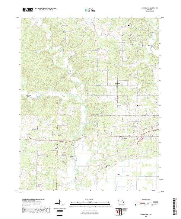
2021 Map of Fairdealing
USGS Topo · Published 2021About this map
Fairdealing and the surrounding drainage of the Little Black River define this rural landscape on the border of Ripley and Butler Counties. The settlement pattern is largely dictated by the area's hydrology, with numerous cemeteries such as Military Cem, Lone Hill Cem, and Dickens Cem situated on higher ground above the river's winding course. The map details a network of secondary roads that link these high points, including the prominent Gobbler Knob and Lone Hill. To the southeast, the terrain transitions as the water is managed through the Taft Ditch near the community of Taft. Genealogists and local historians will find significant value in the distribution of family-named burial grounds like Cochran Cem and Kinsey Cem, as well as landmarks such as the Ball Mill Bridge crossing over Cope Br. This survey illustrates the persistence of small, dispersed communities and the infrastructure required to navigate the area's many tributaries, from Beaverdam Cr to Buzzard Run.
Find a feature on this map
86 named features on this map. Tap any name to fly to it.
Don’t see what you’re looking for? This feature index may not catch every label — zoom into the map to look around manually.
Map Details
Editions of this 2021 Fairdealing Map
This is the sole edition of this map. No revisions or reprints were ever made.
Other maps of this area

1934 · Williamsville
USGS Topo · 1:48,000

1935 · Poplar Bluff
USGS Topo · 1:62,500

1935 · Acorn
USGS Topo · 1:62,500

1935 · Harviell
USGS Topo · 1:62,500

1939 · Poplar Bluff
USGS Topo · 1:62,500

1940 · Williamsville
USGS Topo · 1:62,500

1940 · Naylor
USGS Topo · 1:62,500

1944 · Naylor
USGS Topo · 1:62,500

1949 · Poplar Bluff
USGS Topo · 1:62,500

1957 · Poplar Bluff
USGS Topo · 1:250,000