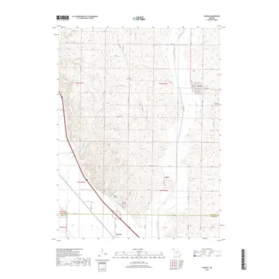
2017 Map of Fairfax
USGS Topo · Published 2017About this map
Fairfax serves as the primary hub in this corner of Northwest Missouri, where the Tarkio River winds through a landscape of bluffs and hollows. The map illustrates a deeply rooted agricultural and rural cemetery network, including Bush Cem, English Grove Cem, and Beck Cem. To the south, the terrain descends toward the Corning area near the Atchison Co Holt Co line, where the local topography transitions at Angel Hollow. This 2017 survey details the intricate township and range system, marking roads such as State Hwy J and State Hwy KK that connect these small communities. The presence of smaller settlements like Milton and features like Happy Hollow Lake underscores the enduring character of these Missouri river-valley uplands, providing a clear view of property boundaries and local landmarks essential for genealogical and land-use research.
Find a feature on this map
72 named features on this map. Tap any name to fly to it.
Don’t see what you’re looking for? This feature index may not catch every label — zoom into the map to look around manually.
Map Details
Editions of this 2017 Fairfax Map
This is the sole edition of this map. No revisions or reprints were ever made.
Other maps of this area

1915 · Falls City
USGS Topo · 1:62,500

1915 · Nemaha
USGS Topo · 1:62,500

1920 · Craig
USGS Topo · 1:62,500

1936 · Fairfax
USGS Topo · 1:24,000

1939 · Tarkio
USGS Topo · 1:62,500

1939 · Nemaha
USGS Topo · 1:62,500

1940 · Tarkio
USGS Topo · 1:62,500

1941 · Tarkio
USGS Topo · 1:62,500

1949 · Nemaha
USGS Topo · 1:62,500

1955 · Nebraska City
USGS Topo · 1:250,000