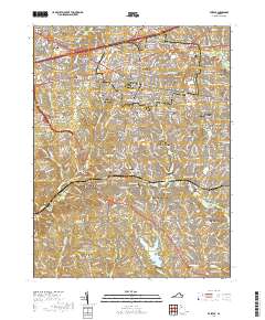
2019 Map of Fairfax
USGS Topo · Published 2019About this map
Burke Lake and the residential expansion of Northern Virginia define this landscape, where the historic seat of Fairfax Station meets modern suburban growth. The presence of numerous family burial grounds, such as the Ratcliffe Family Cem and Coffer Family Cem, serves as a reminder of the area's agricultural past before it became a major educational and civic hub. Institutional anchors like the George Mason University Fairfax Campus and the Fairfax County Courthouse provide a modern contrast to the older crossroads of Jermantown and Fair Oaks. A complex network of stream valleys, including Difficult Run and Popes Head Creek, winds through the many named neighborhoods like Mantua Hills and Fairfax Woods, showing how topography influenced the design of these 20th-century communities.
Find a feature on this map
133 named features on this map. Tap any name to fly to it.
Don’t see what you’re looking for? This feature index may not catch every label — zoom into the map to look around manually.
Map Details
Editions of this 2019 Fairfax Map
This is the sole edition of this map. No revisions or reprints were ever made.
Other maps of this area

1890 · Mt. Vernon
USGS Topo · 1:125,000

1891 · Mt. Vernon
USGS Topo · 1:125,000

1894 · Mt. Vernon
USGS Topo · 1:125,000

1897 · Mt. Vernon
USGS Topo · 1:125,000

1900 · Washington
USGS Topo · 1:62,500

1913 · Indian Head
USGS Topo · 1:62,500

1915 · Fairfax
USGS Topo · 1:62,500

1923 · Indian Head
USGS Topo · 1:48,000

1925 · Indian Head
USGS Topo · 1:62,500

1927 · Quantico
USGS Topo · 1:62,500