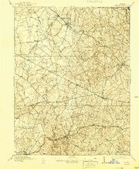
1915 Map of Fairfax
USGS Topo · Published 1944About this map
Fairfax and Manassas serve as the primary hubs in this pre-war survey of Northern Virginia, which depicts a landscape defined by traditional turnpikes and the critical corridors of the Washington and Old Dominion Railroad and the Southern Railroad. The map captures the region when small rural settlements like Chantilly, Floris, and Germantown were distinct communities separated by extensive wooded tracts and a dense network of watercourses, including Difficult Run and Bull Run.
Find a feature on this map
60 named features on this map. Tap any name to fly to it.
Don’t see what you’re looking for? This feature index may not catch every label — zoom into the map to look around manually.
Map Details
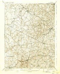
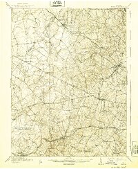
Editions of this 1915 Fairfax Map
4 editions found

Other maps of this area

1884 · Harpers Ferry
USGS Topo · 1:125,000

1890 · Mt. Vernon
USGS Topo · 1:125,000

1891 · Harpers Ferry
USGS Topo · 1:125,000

1891 · Mt. Vernon
USGS Topo · 1:125,000

1893 · Frederick
USGS Topo · 1:125,000

1893 · Harpers Ferry
USGS Topo · 1:125,000

1894 · Warrenton
USGS Topo · 1:125,000

1894 · Frederick
USGS Topo · 1:125,000

1894 · Mt. Vernon
USGS Topo · 1:125,000

1897 · Mt. Vernon
USGS Topo · 1:125,000