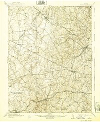
1915 Map of Fairfax
USGS Topo · Published 1939About this map
Northern Virginia before the era of modern suburbanization is defined here by its dependence on the Washington and Old Dominion Railway and the Southern Railway. Based on surveys from 1911-1912, the landscape is dotted with small crossroads communities and rural institutions such as the Bear School and Lee Chapel. The county seat of Fairfax appears as a modest town at the junction of the Little River Road and Braddock Road, while Herndon and Vienna serve as primary rail hubs. The terrain is deeply carved by the drainage basins of Difficult Run and Bull Run, the latter marking the boundary with Prince William County. Small, family-run landmarks like Makely Store and the remote Pleasant Valley School highlight a social geography of scattered farmsteads and narrow turnpikes that existed decades before the expansion of the capital region.
Find a feature on this map
63 named features on this map. Tap any name to fly to it.
Don’t see what you’re looking for? This feature index may not catch every label — zoom into the map to look around manually.
Map Details
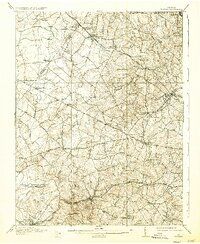
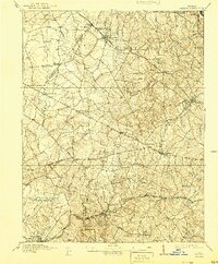
Editions of this 1915 Fairfax Map
4 editions found

Other maps of this area

1884 · Harpers Ferry
USGS Topo · 1:125,000

1890 · Mt. Vernon
USGS Topo · 1:125,000

1891 · Harpers Ferry
USGS Topo · 1:125,000

1891 · Mt. Vernon
USGS Topo · 1:125,000

1893 · Frederick
USGS Topo · 1:125,000

1893 · Harpers Ferry
USGS Topo · 1:125,000

1894 · Warrenton
USGS Topo · 1:125,000

1894 · Frederick
USGS Topo · 1:125,000

1894 · Mt. Vernon
USGS Topo · 1:125,000

1897 · Mt. Vernon
USGS Topo · 1:125,000