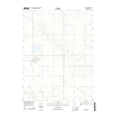
2014 Map of Fairfield
USGS Topo · Published 2014About this map
Fairfield anchors this Clay County landscape, where the street grid is organized around central arteries like Fairfield Ave and W 4th St. The surrounding countryside is defined by the Jeffersonian grid system, with a network of rural roads such as Road 11 and Road 32 segmenting the agricultural land. Water management is a central theme of this terrain, evidenced by the series of impoundments in the south and east, including Skalka Reservoir, Harms-Skalka Reservoir, and Fisher Reservoir Number 1. These reservoirs interact with the natural drainage of Big Sandy Cr and Buffalo Cr, illustrating the modern adaptation of the Nebraska plains to support local farming. Genealogists will find the Fairfield Cem located south of the town center, a primary landmark for tracing local family histories within this rural township.
Find a feature on this map
34 named features on this map. Tap any name to fly to it.
Don’t see what you’re looking for? This feature index may not catch every label — zoom into the map to look around manually.
Map Details
Editions of this 2014 Fairfield Map
This is the sole edition of this map. No revisions or reprints were ever made.
Other maps of this area

1898 · York
USGS Topo · 1:125,000

1898 · Superior
USGS Topo · 1:125,000

1898 · Hebron
USGS Topo · 1:125,000

1898 · Grand Island
USGS Topo · 1:125,000

1899 · York
USGS Topo · 1:125,000

1955 · Lincoln
USGS Topo · 1:250,000

1955 · Grand Island
USGS Topo · 1:250,000

1957 · Lincoln
USGS Topo · 1:250,000

1957 · Grand Island
USGS Topo · 1:250,000

1958 · Grand Island
USGS Topo · 1:250,000