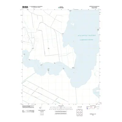
2010 Map of Fairfield NE
USGS Topo · Published 2010About this map
The Alligator River snakes through this coastal landscape, meeting the Albemarle Sound amidst a network of points and landings in Dare County. Remote shoreline features like Tuckahoe Point, Bear Point, and Newport News Point define the water's edge, while the inland territory is shaped by the Pungo-River-Alligator-River-Canal. This waterway system provided critical drainage and transport routes through the low-lying terrain, linking disparate parts of the inner coast.
Find a feature on this map
34 named features on this map. Tap any name to fly to it.
Don’t see what you’re looking for? This feature index may not catch every label — zoom into the map to look around manually.
Map Details
Editions of this 2010 Fairfield NE Map
This is the sole edition of this map. No revisions or reprints were ever made.
Other maps of this area

1943 · Columbia
USGS Topo · 1:125,000

1943 · Roanoke Island
USGS Topo · 1:125,000

1951 · Engelhard West
USGS Topo · 1:24,000

1951 · Engelhard East
USGS Topo · 1:24,000

1951 · Fairfield
USGS Topo · 1:24,000

1953 · Engelhard NW
USGS Topo · 1:24,000

1953 · Buffalo City
USGS Topo · 1:24,000

1953 · Fairfield NE
USGS Topo · 1:24,000

1953 · Scotia
USGS Topo · 1:24,000

1953 · Frying Pan
USGS Topo · 1:24,000