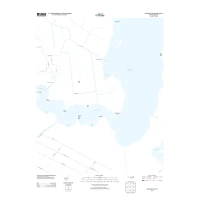
2013 Map of Fairfield NE
USGS Topo · Published 2013About this map
Gum Neck Landing and Grapevine Landing anchor the edge of this low-lying coastal landscape, where the Alligator River meets a network of bays and points. The area is defined by its isolation and water-dependent infrastructure, notably the Pungo River Alligator River Canal which cuts through the southern reaches. A grid of local roads, including Buck Ridge Rd and various numbered avenues, provides access to inland locations like Buck Island, surrounded by wetlands and secondary waterways such as Gum Neck Cr. To the east, the map captures the transition into the Atlantic Ocean and the intricate shoreline marked by locally named landmarks like Rattlesnake Bay, Newport News Point, and Clabber Point. The presence of Swan Creek Lake in the southeast corner further emphasizes the saturated, hydraulic nature of this coastal North Carolina environment.
Find a feature on this map
41 named features on this map. Tap any name to fly to it.
Don’t see what you’re looking for? This feature index may not catch every label — zoom into the map to look around manually.
Map Details
Editions of this 2013 Fairfield NE Map
This is the sole edition of this map. No revisions or reprints were ever made.
Other maps of this area

1943 · Columbia
USGS Topo · 1:125,000

1943 · Roanoke Island
USGS Topo · 1:125,000

1951 · Engelhard West
USGS Topo · 1:24,000

1951 · Engelhard East
USGS Topo · 1:24,000

1951 · Fairfield
USGS Topo · 1:24,000

1953 · Engelhard NW
USGS Topo · 1:24,000

1953 · Buffalo City
USGS Topo · 1:24,000

1953 · Fairfield NE
USGS Topo · 1:24,000

1953 · Scotia
USGS Topo · 1:24,000

1953 · Frying Pan
USGS Topo · 1:24,000