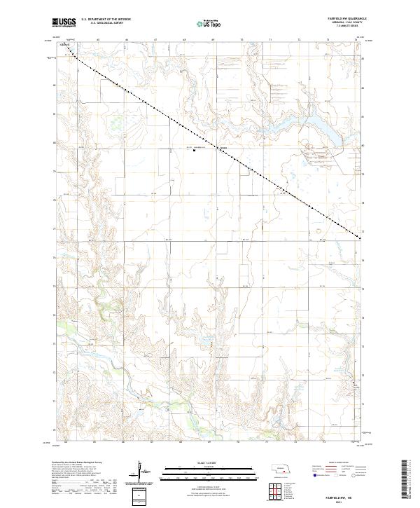
2021 Map of Fairfield NW
USGS Topo · Published 2021About this map
The Little Blue River winds through the southwestern corner of this Clay County landscape, marking a transition from the structured grid of Section 17 and Section 16 to the more complex riparian drainage. Agriculture and water management define the region, evidenced by a series of named catchments such as Nejezchleb Reservoir, Lipovsky Reservoir, and Lambie Reservoir that intercept local drainage from Buffalo Cr and Pawnee Cr.
Find a feature on this map
33 named features on this map. Tap any name to fly to it.
Don’t see what you’re looking for? This feature index may not catch every label — zoom into the map to look around manually.
Map Details
Editions of this 2021 Fairfield NW Map
This is the sole edition of this map. No revisions or reprints were ever made.
Other maps of this area

1898 · Superior
USGS Topo · 1:125,000

1898 · Grand Island
USGS Topo · 1:125,000

1955 · Grand Island
USGS Topo · 1:250,000

1957 · Grand Island
USGS Topo · 1:250,000

1958 · Grand Island
USGS Topo · 1:250,000
1960 · Fairfield SE
USGS Topo · 1:24,000

1960 · Deweese
USGS Topo · 1:24,000

1969 · Hastings East
USGS Topo · 1:24,000

1969 · Fairfield NW
USGS Topo · 1:24,000

1969 · Lawrence
USGS Topo · 1:24,000