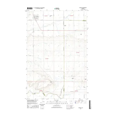
2017 Map of Fairfield
USGS Topo · Published 2017About this map
Fairfield serves as the focal point of this northern Montana landscape, where the grid of the town site meets a complex system of agricultural water management. The topography is defined by a series of distinct plateaus including Greenfields Bench, Second Bench, and First Bench, which overlook the descent toward the Sun River at the southern edge of the quadrangle. An extensive network of irrigation infrastructure, including the Greenfields Main Canal, Hamilton Canal, and Big Coulee Canal, illustrates the region's reliance on managed water for the surrounding plains. To the southwest of the town, Sunset Hills Cem marks a local landmark, while the terrain becomes more varied as it transitions into coulees like Blackfoot Coulee and Anderson Coulee. The map also captures the crossing of the Teton and Cascade county line and the prominence of Floweree Butte rising above the lower benches.
Find a feature on this map
40 named features on this map. Tap any name to fly to it.
Don’t see what you’re looking for? This feature index may not catch every label — zoom into the map to look around manually.
Map Details
Editions of this 2017 Fairfield Map
This is the sole edition of this map. No revisions or reprints were ever made.
Other maps of this area

1886 · Great Falls
USGS Topo · 1:250,000

1920 · Choteau
USGS Topo · 1:125,000

1943 · Hogan
USGS Topo · 1:125,000

1950 · Fairfield
USGS Topo · 1:62,500

1954 · Great Falls
USGS Topo · 1:250,000

1955 · Choteau
USGS Topo · 1:250,000

1957 · Choteau
USGS Topo · 1:250,000

1957 · Great Falls
USGS Topo · 1:250,000

1958 · Choteau
USGS Topo · 1:250,000

1960 · Simms
USGS Topo · 1:62,500