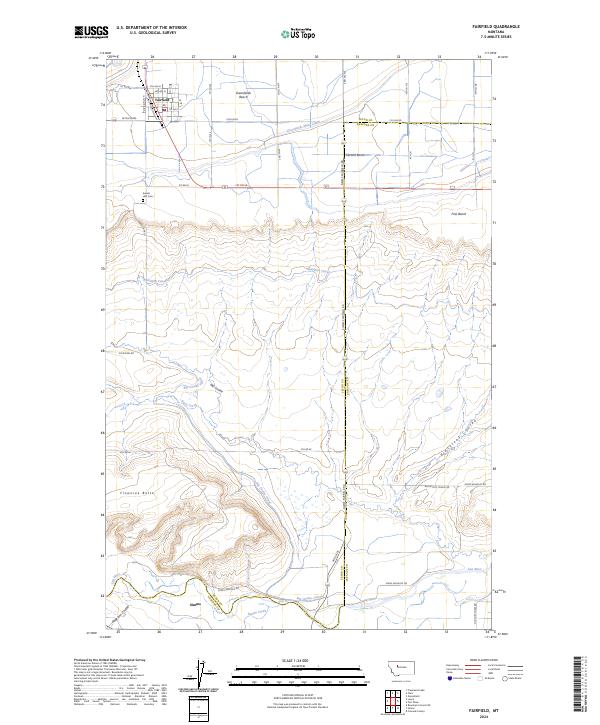
2024 Map of Fairfield
USGS Topo · Published 2024About this map
Fairfield stands as a central agricultural hub atop the Greenfields Bench, where a grid of rural roads and irrigation works defines the high plains landscape. The Greenfields Main Canal and Hamilton Canal demonstrate the intensive water management required to sustain this region, carving paths through the terrain to support local farms. South of the bench, the land drops toward the Sun River valley, passing the prominent landmark of Floweree Butte and the drainage of Big Coulee. This transition from the flat, irrigated plateaus of the north to the meandering river bottom near Simms highlights the geographic contrast between the managed benchlands and the natural riparian system. Local history is anchored by sites like Sunset Hills Cemetery and the many named coulees, including Blackfoot Coulee and Anderson Coulee, which provide vital drainage for the surrounding cattle country and wheat fields.
Find a feature on this map
40 named features on this map. Tap any name to fly to it.
Don’t see what you’re looking for? This feature index may not catch every label — zoom into the map to look around manually.
Map Details
Editions of this 2024 Fairfield Map
This is the sole edition of this map. No revisions or reprints were ever made.
Other maps of this area

1886 · Great Falls
USGS Topo · 1:250,000

1920 · Choteau
USGS Topo · 1:125,000

1943 · Hogan
USGS Topo · 1:125,000

1950 · Fairfield
USGS Topo · 1:62,500

1954 · Great Falls
USGS Topo · 1:250,000

1955 · Choteau
USGS Topo · 1:250,000

1957 · Choteau
USGS Topo · 1:250,000

1957 · Great Falls
USGS Topo · 1:250,000

1958 · Choteau
USGS Topo · 1:250,000

1960 · Simms
USGS Topo · 1:62,500