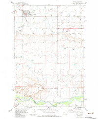
1983 Map of Fairfield
USGS Topo · Published 1983About this map
The town of Fairfield serves as the focal point of this 1980s landscape, positioned atop the Greenfields Bench and supported by a complex irrigation network including the Greenfields Main Canal and Hamilton Canal. The mapping reveals a distinct agricultural and industrial structure, evidenced by Storage Bins and a network of canals that feed the surrounding benches. In the southern reaches, the Sun River meanders through a valley marked by an Old Railroad Grade and Anderson Coulee, showing the transition from the high flatlands to the river bottom.
Find a feature on this map
27 named features on this map. Tap any name to fly to it.
Don’t see what you’re looking for? This feature index may not catch every label — zoom into the map to look around manually.
Map Details
Editions of this 1983 Fairfield Map
This is the sole edition of this map. No revisions or reprints were ever made.
Other maps of this area

1886 · Great Falls
USGS Topo · 1:250,000

1920 · Choteau
USGS Topo · 1:125,000

1943 · Hogan
USGS Topo · 1:125,000

1950 · Fairfield
USGS Topo · 1:62,500

1954 · Great Falls
USGS Topo · 1:250,000

1955 · Choteau
USGS Topo · 1:250,000

1957 · Choteau
USGS Topo · 1:250,000

1957 · Great Falls
USGS Topo · 1:250,000

1958 · Choteau
USGS Topo · 1:250,000

1960 · Simms
USGS Topo · 1:62,500