Loading...
Loading map...1917 Map of Fairfield
USGS Topo · Published 1948About this map
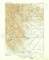
Mining operations and military land use define the landscape of the Oak Traverse Mts and surrounding valleys during this 1915 survey. The town of Mercur is a focal point of industrial activity, surrounded by workings like the Sacramento Mine, Franklin Lease Mine, and Chloride Point Mine. This extraction economy in the Oquirrh range contrasts with the lower elevations of Cedar Valley, where the State Military Reservation occupies a significant portion of the eastern terrain.
Find a feature on this map
95 named features on this map. Tap any name to fly to it.
Don’t see what you’re looking for? This feature index may not catch every label — zoom into the map to look around manually.
Map Details
Date Portrayed1917
Date Published1948
PublisherU.S. Geological Survey
Map TypeTopographic
Scale1:62,500
Physical Dimensions16.9 x 20.7 inches
Editions of this 1917 Fairfield Map
2 editions found

Historical Maps of Eagle Mountain Through Time

Featured Locations
Source Details
SourceU.S. Geological Survey
CopyrightPublic Domain