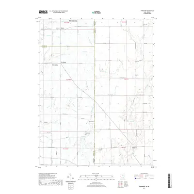
2019 Map of Fairhaven
USGS Topo · Published 2019About this map
Fairhaven sits at the center of a rural landscape spanning the Indiana-Ohio border, where Preble, Wayne, and Union Counties meet. This agricultural region is defined by a dense network of watercourses, including the north-flowing Little Four Mile Cr and Toney Run. These streams cut through the terrain, necessitating historic crossings like the Harshman Bridge. Smaller clusters of settlement such as Five Points and Witts Station are scattered across the township lines, connected by roads that frequently follow the rigid geometry of the Public Land Survey System. For family history researchers, the map identifies several local burial grounds, including Concord Cem, Railsback Cem, and Pentecost Cem, which serve as vital markers of the early communities that established these borderlands. The interplay of named runs and creeks like Silver Cr and Railsback Cr highlights the natural drainage patterns that have historically shaped local land use and farm boundaries.
Find a feature on this map
64 named features on this map. Tap any name to fly to it.
Don’t see what you’re looking for? This feature index may not catch every label — zoom into the map to look around manually.
Map Details
Editions of this 2019 Fairhaven Map
This is the sole edition of this map. No revisions or reprints were ever made.
Other maps of this area

1911 · Oxford
USGS Topo · 1:62,500

1915 · New Paris
USGS Topo · 1:48,000

1915 · College Corner
USGS Topo · 1:48,000

1918 · College Corner
USGS Topo · 1:62,500

1918 · New Paris
USGS Topo · 1:62,500

1948 · Fairfield
USGS Topo · 1:24,000

1953 · Cincinnati
USGS Topo · 1:250,000

1957 · Cincinnati
USGS Topo · 1:250,000

1960 · Liberty
USGS Topo · 1:24,000

1960 · Fairhaven
USGS Topo · 1:24,000