
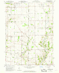
1960 Map of Fairhaven
USGS Topo · Published 1961About this map
The Indiana-Ohio border region north of College Corner Road defines the rural character of this 1960 survey, where small agricultural hamlets like Fairhaven and Kitchel serve as the primary social hubs. The Chesapeake and Ohio railroad cuts a diagonal path through the landscape, connecting Boston and Witts Station to the wider trade networks of the mid-century. This is a landscape of established family farms and local institutions, evidenced by the scattered California School and Dixon-Israel Township Sch, and the presence of the Sugar Grove Ch and Pentecost Cem. In the northwest, the edge of the Richmond Municipal Airport signals the increasing modern infrastructure of the era, while the eastern portion remains focused on the drainage of Four Mile Creek and its many tributaries.
Find a feature on this map
67 named features on this map. Tap any name to fly to it.
Don’t see what you’re looking for? This feature index may not catch every label — zoom into the map to look around manually.
Map Details
Editions of this 1960 Fairhaven Map
2 editions found
Other maps of this area

1911 · Oxford
USGS Topo · 1:62,500

1915 · New Paris
USGS Topo · 1:48,000

1915 · College Corner
USGS Topo · 1:48,000

1918 · College Corner
USGS Topo · 1:62,500

1918 · New Paris
USGS Topo · 1:62,500

1948 · Fairfield
USGS Topo · 1:24,000

1953 · Cincinnati
USGS Topo · 1:250,000

1957 · Cincinnati
USGS Topo · 1:250,000

1960 · Liberty
USGS Topo · 1:24,000
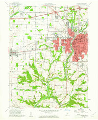
1960 · Richmond
USGS Topo · 1:24,000