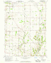
1960 Map of Fairhaven
USGS Topo · Published 1969About this map
The State Line between Indiana and Ohio defines the character of this borderland landscape, where rural townships like Harrison and Dixon intersect. Transport and logistics are central to the area's development, evidenced by the Chesapeake and Ohio railroad running through Witts Station and the sprawling grounds of the Richmond Municipal Airport in the north.
Find a feature on this map
59 named features on this map. Tap any name to fly to it.
Don’t see what you’re looking for? This feature index may not catch every label — zoom into the map to look around manually.
Map Details
Editions of this 1960 Fairhaven Map
2 editions found
Other maps of this area

1911 · Oxford
USGS Topo · 1:62,500

1915 · New Paris
USGS Topo · 1:48,000

1915 · College Corner
USGS Topo · 1:48,000

1918 · College Corner
USGS Topo · 1:62,500

1918 · New Paris
USGS Topo · 1:62,500

1948 · Fairfield
USGS Topo · 1:24,000

1953 · Cincinnati
USGS Topo · 1:250,000

1957 · Cincinnati
USGS Topo · 1:250,000

1960 · Liberty
USGS Topo · 1:24,000

1960 · Fairhaven
USGS Topo · 1:24,000