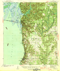
1944 Map of Fairhope
USGS Topo · Published 1944About this map
Civil War Trenches overlook the bluffs at Blakeley, where the high ground of Baldwin County meets the intricate river delta of the Apalachee River and Blakeley River. This 1944 survey captures the Eastern Shore of Mobile Bay during a period of significant agricultural and institutional development. The map details established coastal communities like Fairhope, Daphne, and Montrose, while highlighting inland cultural landmarks such as Bohemian Hall and the Friends Meetinghouse.
Find a feature on this map
78 named features on this map. Tap any name to fly to it.
Don’t see what you’re looking for? This feature index may not catch every label — zoom into the map to look around manually.
Map Details
Editions of this 1944 Fairhope Map
3 editions found
Other maps of this area

1920 · Robertsdale
USGS Topo · 1:62,500

1921 · Bon Secour
USGS Topo · 1:62,500

1921 · Point Clear
USGS Topo · 1:62,500

1921 · Fairhope
USGS Topo · 1:62,500

1921 · Delchamps
USGS Topo · 1:62,500

1922 · Mobile
USGS Topo · 1:62,500

1939 · Daphne
USGS Topo · 1:31,680

1940 · Silverhill
USGS Topo · 1:31,680

1940 · Hollingers Island
USGS Topo · 1:31,680

1940 · Mobile
USGS Topo · 1:31,680