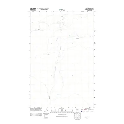
2013 Map of Fairland
USGS Topo · Published 2013About this map
Fairland sits along the winding course of the Black River in this northern Minnesota landscape, where the terrain is defined by low-lying waterways and managed forest access. The presence of the Indian Pines Lookout Tower near the northern edge emphasizes the importance of fire surveillance in this timber-heavy region. Navigation through the area is primarily supported by specialized forest routes such as State Fire Rd, Indian Pines Rd, and the extensive Fiero Truck Trl, which tracks the river's path southward. This survey captures a specific era of land management in Koochiching County, illustrating how isolated settlements like Fairland integrated with the state's forest protection infrastructure through a network of truck trails and fire roads.
Find a feature on this map
6 named features on this map. Tap any name to fly to it.
Don’t see what you’re looking for? This feature index may not catch every label — zoom into the map to look around manually.
Map Details
Editions of this 2013 Fairland Map
This is the sole edition of this map. No revisions or reprints were ever made.
Other maps of this area

1919 · Birchdale
USGS Topo · 1:62,500

1919 · I
USGS Topo · 1:62,500

1954 · Roseau
USGS Topo · 1:250,000

1957 · Roseau
USGS Topo · 1:250,000

1958 · Roseau
USGS Topo · 1:250,000

1968 · Birchdale SW
USGS Topo · 1:24,000

1968 · Birchdale SE
USGS Topo · 1:24,000

1968 · Clementson SE
USGS Topo · 1:24,000
1973 · Fairland NE
USGS Topo · 1:24,000
1973 · Giant Pine Campground
USGS Topo · 1:24,000