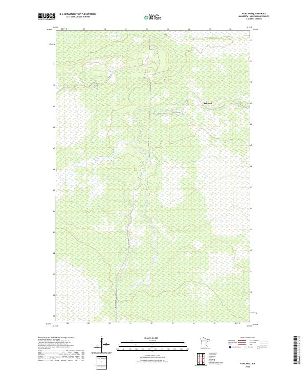
2022 Map of Fairland
USGS Topo · Published 2022About this map
Black River meanders through a landscape defined by extensive wetlands and isolated routes in this part of Koochiching County. The small settlement of Fairland serves as the primary point of reference, situated where Black River Rd meets the surrounding wilderness. The terrain is largely dominated by the natural drainage patterns of the river system, which dictates the layout of the few established thoroughfares like Fiero Truck Trl and Indian Pines Rd. This area reflects the remote character of Northern Minnesota, where the Public Land Survey System grids, such as t158n r27w and t157n r28w, segment a territory primarily used for timber or conservation rather than dense habitation. For those tracing the evolution of local infrastructure, the map highlights how modern access points follow the historical corridors of truck trails and rural roads.
Find a feature on this map
9 named features on this map. Tap any name to fly to it.
Don’t see what you’re looking for? This feature index may not catch every label — zoom into the map to look around manually.
Map Details
Editions of this 2022 Fairland Map
This is the sole edition of this map. No revisions or reprints were ever made.
Other maps of this area

1919 · Birchdale
USGS Topo · 1:62,500

1919 · I
USGS Topo · 1:62,500

1954 · Roseau
USGS Topo · 1:250,000

1957 · Roseau
USGS Topo · 1:250,000

1958 · Roseau
USGS Topo · 1:250,000

1968 · Birchdale SW
USGS Topo · 1:24,000

1968 · Birchdale SE
USGS Topo · 1:24,000

1968 · Clementson SE
USGS Topo · 1:24,000
1973 · Fairland NE
USGS Topo · 1:24,000
1973 · Giant Pine Campground
USGS Topo · 1:24,000