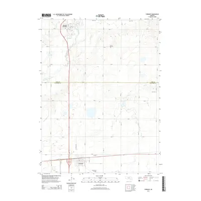
2014 Map of Fairmont
USGS Topo · Published 2014About this map
Fairmont and McCool Junction anchor this portion of the Nebraska plains, where the grid of rural roads meets the diagonal path of Us-81. The landscape is defined by the agricultural layout of the York and Fillmore county line, intersected by the winding course of the West Fork Big Blue River. Water management is central to the area's geography, visible through features like the Weiss Reservoir and the drainage of Indian Cr and Stone Cr.
Find a feature on this map
24 named features on this map. Tap any name to fly to it.
Don’t see what you’re looking for? This feature index may not catch every label — zoom into the map to look around manually.
Map Details
Editions of this 2014 Fairmont Map
This is the sole edition of this map. No revisions or reprints were ever made.
Other maps of this area

1898 · York
USGS Topo · 1:125,000

1899 · York
USGS Topo · 1:125,000

1934 · Utica
USGS Topo · 1:62,500

1937 · Utica
USGS Topo · 1:62,500

1955 · Lincoln
USGS Topo · 1:250,000

1957 · Lincoln
USGS Topo · 1:250,000

1958 · Lincoln
USGS Topo · 1:250,000
1969 · Utica SW
USGS Topo · 1:24,000
1969 · Geneva
USGS Topo · 1:24,000

1969 · Fairmont
USGS Topo · 1:24,000