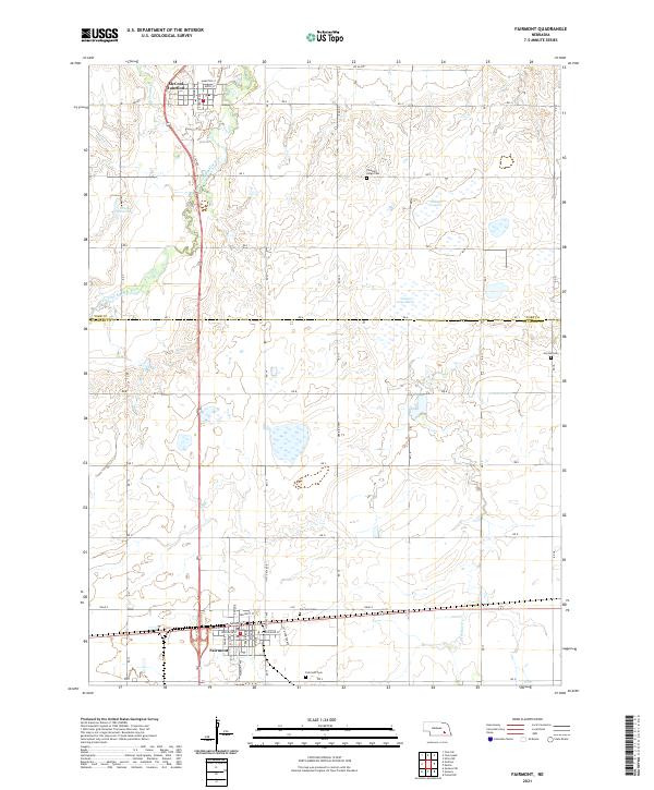
2021 Map of Fairmont
USGS Topo · Published 2021About this map
Fairmont stands at the southern edge of this West Nebraska landscape, where the D-S Railway St meets a grid of established streets like Jefferson St and Main St. To the north, the terrain is defined by the wandering course of the West Fork Big Blue River and its tributaries, Galaway Cr and Stone Cr. This area illustrates a classic plains agricultural layout, punctuated by localized depressions such as Sininger Lagoon and the County Line Marsh along the border between York and Fillmore Counties.
Find a feature on this map
38 named features on this map. Tap any name to fly to it.
Don’t see what you’re looking for? This feature index may not catch every label — zoom into the map to look around manually.
Map Details
Editions of this 2021 Fairmont Map
This is the sole edition of this map. No revisions or reprints were ever made.
Other maps of this area

1898 · York
USGS Topo · 1:125,000

1899 · York
USGS Topo · 1:125,000

1934 · Utica
USGS Topo · 1:62,500

1937 · Utica
USGS Topo · 1:62,500

1955 · Lincoln
USGS Topo · 1:250,000

1957 · Lincoln
USGS Topo · 1:250,000

1958 · Lincoln
USGS Topo · 1:250,000
1969 · Utica SW
USGS Topo · 1:24,000
1969 · Geneva
USGS Topo · 1:24,000

1969 · Fairmont
USGS Topo · 1:24,000