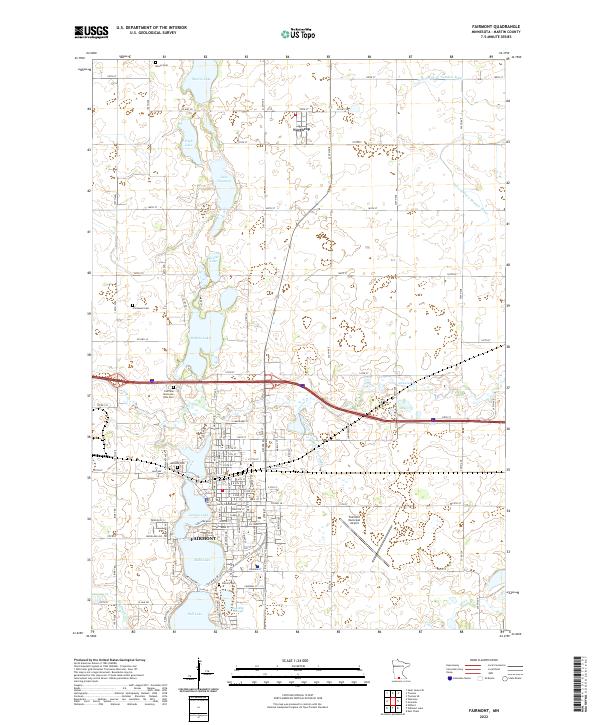
2022 Map of Fairmont
USGS Topo · Published 2022About this map
The southern Minnesota city of Fairmont centers this survey, revealing a landscape defined by an interconnected chain of glacial lakes. From George Lake and Budd Lake in the city center down to Hall Lake, the water forms a natural spine for the community. The Martin County Courthouse stands near the shore, marking the civic heart of the region. Outside the urban core, the terrain is partitioned by a meticulous grid of rural roads and an extensive network of drainage infrastructure, including Judicial Ditch Number Three and Judicial Ditch Number Eight, which supported the area's intensive agricultural development.
Find a feature on this map
72 named features on this map. Tap any name to fly to it.
Don’t see what you’re looking for? This feature index may not catch every label — zoom into the map to look around manually.
Map Details
Editions of this 2022 Fairmont Map
This is the sole edition of this map. No revisions or reprints were ever made.
Other maps of this area

1954 · Fairmont
USGS Topo · 1:250,000

1958 · Fairmont
USGS Topo · 1:250,000

1967 · Truman
USGS Topo · 1:24,000

1967 · East Chain
USGS Topo · 1:24,000

1967 · Wilmert Lake
USGS Topo · 1:24,000

1967 · Truman SE
USGS Topo · 1:24,000

1967 · Granada
USGS Topo · 1:24,000

1967 · Fairmont
USGS Topo · 1:24,000

1970 · St James SE
USGS Topo · 1:24,000

1970 · Welcome
USGS Topo · 1:24,000