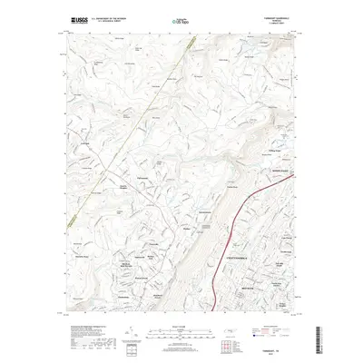
2019 Map of Fairmount
USGS Topo · Published 2019About this map
Signal Mountain and the surrounding plateau communities are defined by the sharp transition from the residential neighborhoods of Chattanooga to the high ridges of the Cumberland Escarpment. This modern era study illustrates the dense suburban expansion in areas like Red Bank and North Glen Estates while the higher elevations remain dominated by protected terrain and heritage sites. The Cumberland Trail winds across the landscape, passing significant natural landmarks such as the N Chickamauga Creek Gorge and the Chickamauga Gulch. Local history is preserved in numerous family and community burial grounds, including the Fairmount Cem, Levi Cem, and the high-elevation Hall Cem near Lone Oak. The map details how modern development in Soddy-Daisy and Falling Water follows the old transport corridors of the Old Dayton Pike and the Dayton Blvd, contrasting the concentrated residential clusters of Shepherd Forest and Timesville with the rugged breaks of Adams Ridge and Gadd Ridge.
Find a feature on this map
256 named features on this map. Tap any name to fly to it.
Don’t see what you’re looking for? This feature index may not catch every label — zoom into the map to look around manually.
Map Details
Editions of this 2019 Fairmount Map
This is the sole edition of this map. No revisions or reprints were ever made.
Other maps of this area

1888 · Chattanooga
USGS Topo · 1:125,000

1893 · Chattanooga
USGS Topo · 1:125,000

1935 · East Chattanooga
USGS Topo · 1:24,000

1935 · Daisy
USGS Topo · 1:24,000

1935 · Soddy
USGS Topo · 1:24,000

1936 · Daus
USGS Topo · 1:24,000

1936 · Henson Gap
USGS Topo · 1:24,000

1936 · Ketner Gap
USGS Topo · 1:24,000

1936 · Fairmount
USGS Topo · 1:24,000

1936 · Wauhatchie
USGS Topo · 1:24,000