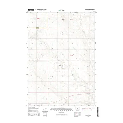
2015 Map of Fairpoint SW
USGS Topo · Published 2015About this map
The High Plains of Butte and Meade counties are defined here by a series of prominent ridges and drainage basins. Elm Butte Divide and Eightmile Divide act as the primary geographic markers, channeling seasonal runoff through a network of creeks. Waterways such as Lone Tree Cr, W Elm Cr, and Crooked Elm Cr carve through the landscape, creating the distinct topography of Browns Draw.
Find a feature on this map
19 named features on this map. Tap any name to fly to it.
Don’t see what you’re looking for? This feature index may not catch every label — zoom into the map to look around manually.
Map Details
Editions of this 2015 Fairpoint SW Map
This is the sole edition of this map. No revisions or reprints were ever made.
Other maps of this area

1893 · Rapid
USGS Topo · 1:125,000

1898 · Rapid
USGS Topo · 1:125,000

1903 · Rapid
USGS Topo · 1:125,000

1913 · Newell
USGS Topo · 1:125,000

1951 · Volunteer SE
USGS Topo · 1:24,000

1953 · Hereford
USGS Topo · 1:24,000

1953 · Rapid City 1 NE
USGS Topo · 1:24,000

1953 · Hereford NE
USGS Topo · 1:24,000

1953 · Rapid City
USGS Topo · 1:250,000

1957 · Rapid City
USGS Topo · 1:250,000