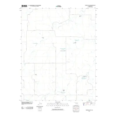
2010 Map of Fairvalley SE
USGS Topo · Published 2010About this map
Highland Cemetery and the prominent geological formation of Chimney Rock anchor this survey of rural Woodward County, Oklahoma. The landscape is defined by the drainages of Chimney Creek and Sand Creek, which have been extensively modified by water management infrastructure. A series of private or local reservoirs, including Lockhart Reservoir, Gardner Number 1 Reservoir, and the Matteson Number 2 Reservoir, are situated throughout the quadrangle, each secured by its respective dam such as the Bingham Dam or the Matteson Number 2b Dam. This network of small-scale impoundments reflects the agricultural and livestock-focused land use of the region in the early 21st century. The map also documents a grid of rural section roads, including e0320 RD and n2210 RD, which provide access to these remote water sources and landmarks.
Find a feature on this map
35 named features on this map. Tap any name to fly to it.
Don’t see what you’re looking for? This feature index may not catch every label — zoom into the map to look around manually.
Map Details
Editions of this 2010 Fairvalley SE Map
This is the sole edition of this map. No revisions or reprints were ever made.
Other maps of this area

1955 · Woodward
USGS Topo · 1:250,000

1958 · Woodward
USGS Topo · 1:250,000

1969 · Belva
USGS Topo · 1:24,000

1969 · Quinlan
USGS Topo · 1:24,000

1969 · Waynoka NW
USGS Topo · 1:24,000

1969 · Mooreland
USGS Topo · 1:24,000

1969 · Waynoka West
USGS Topo · 1:24,000

1970 · Fairvalley SW
USGS Topo · 1:24,000

1970 · Alabaster Caverns
USGS Topo · 1:24,000

1970 · Fairvalley SE
USGS Topo · 1:24,000