
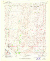
1970 Map of Fairvalley
USGS Topo · Published 1972About this map
The Cimarron River carves a broad valley through the borderlands of Woods Co and Woodward Co, shaping a landscape defined by sharp drainage breaks and remote prairie settlements. In the early 1970s, the rural community of Fairvalley and the smaller Redhorse location represent the sparse human footprint in this corner of northwest Oklahoma. The Atchison Topeka and Santa Fe railroad line runs parallel to the river's northern bank, serving as the primary industrial artery through the terrain. Evidence of natural resource extraction is visible through scattered Gas Wells and a Drill Hole located near the river's edge. Numerous small tributaries, including Whitehorse Creek, Wildcat Creek, and Long Creek, feed into the Cimarron, creating a complex network of canyons and ridges across the Penn, MC Kinley, and Union townships.
Find a feature on this map
19 named features on this map. Tap any name to fly to it.
Don’t see what you’re looking for? This feature index may not catch every label — zoom into the map to look around manually.
Map Details
Editions of this 1970 Fairvalley Map
This is the sole edition of this map. No revisions or reprints were ever made.
Other maps of this area

1955 · Woodward
USGS Topo · 1:250,000

1958 · Woodward
USGS Topo · 1:250,000

1969 · Waynoka NW
USGS Topo · 1:24,000

1969 · Tegarden
USGS Topo · 1:24,000

1969 · Waynoka West
USGS Topo · 1:24,000

1970 · Fairvalley SW
USGS Topo · 1:24,000

1970 · Alabaster Caverns
USGS Topo · 1:24,000

1970 · Fairvalley SE
USGS Topo · 1:24,000

1970 · Edith
USGS Topo · 1:24,000
1970 · Freedom
USGS Topo · 1:24,000