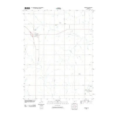
2009 Map of Fairview
USGS Topo · Published 2009About this map
Fairview and Powhattan serve as the primary anchors of this Kansas prairie landscape, connected by a network of named rural roads. The area is heavily defined by its headwaters and drainage systems, with the Delaware River and its tributary, the Little Delaware River, winding through the southern reaches. Numerous creeks including Walnut Creek, Spring Creek, and Mulberry Creek carve across the township sections, illustrating the natural water distribution that historically dictated agricultural patterns and homestead placement.
Find a feature on this map
39 named features on this map. Tap any name to fly to it.
Don’t see what you’re looking for? This feature index may not catch every label — zoom into the map to look around manually.
Map Details
Editions of this 2009 Fairview Map
This is the sole edition of this map. No revisions or reprints were ever made.
Other maps of this area

1888 · Hiawatha
USGS Topo · 1:125,000

1894 · Hiawatha
USGS Topo · 1:125,000

1950 · Kansas City
USGS Topo · 1:250,000

1954 · Kansas City
USGS Topo · 1:250,000

1956 · Kansas City
USGS Topo · 1:250,000
1959 · Morrill
USGS Topo · 1:24,000

1960 · Kansas City
USGS Topo · 1:250,000
1960 · Sabetha
USGS Topo · 1:24,000

1960 · Fairview
USGS Topo · 1:24,000
1960 · Horton NW
USGS Topo · 1:24,000