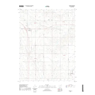
2018 Map of Fairview
USGS Topo · Published 2018About this map
Fairview and Powhattan serve as the primary anchors for this section of Brown County, where a dense network of sectional roads like Coyote Rd and Dewberry Rd crisscross a landscape defined by an intricate drainage system. The terrain is deeply carved by the Delaware River and its various tributaries, including the Little Delaware River, Wolf River, and Squaw Creek. This 2018 survey reveals a high concentration of burial grounds that mark the heritage of early local families, such as the Lambertson Cemetery and Comet Cemetery. The presence of the Immanuel Lutheran Cemetery and Saint Paul Cemetery north of the primary road corridors suggests the enduring locations of historic rural congregations. In Powhattan, the grid remains tight around 3rd St, reflecting the town's compact development amidst the surrounding agricultural acreage and river valleys.
Find a feature on this map
47 named features on this map. Tap any name to fly to it.
Don’t see what you’re looking for? This feature index may not catch every label — zoom into the map to look around manually.
Map Details
Editions of this 2018 Fairview Map
This is the sole edition of this map. No revisions or reprints were ever made.
Other maps of this area

1888 · Hiawatha
USGS Topo · 1:125,000

1894 · Hiawatha
USGS Topo · 1:125,000

1950 · Kansas City
USGS Topo · 1:250,000

1954 · Kansas City
USGS Topo · 1:250,000

1956 · Kansas City
USGS Topo · 1:250,000
1959 · Morrill
USGS Topo · 1:24,000

1960 · Kansas City
USGS Topo · 1:250,000
1960 · Sabetha
USGS Topo · 1:24,000

1960 · Fairview
USGS Topo · 1:24,000
1960 · Horton NW
USGS Topo · 1:24,000