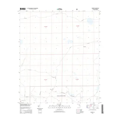
2015 Map of Fairview
USGS Topo · Published 2015About this map
Osceola National Forest encompasses the southern portion of this landscape, where the Green Horse Trail meanders through the pine-dominated flatwoods typical of the Florida Panhandle's interior. The small community of Fairview serves as a central hub for the area, situated at the junction of several rural routes including Sand Hill Rd and Fairview Rd. The terrain is characterized by numerous small, seasonally wet depressions and drainages, most notably Little Cr in the northwest, which illustrate the subtle hydrology of northern Columbia County.
Find a feature on this map
15 named features on this map. Tap any name to fly to it.
Don’t see what you’re looking for? This feature index may not catch every label — zoom into the map to look around manually.
Map Details
Editions of this 2015 Fairview Map
This is the sole edition of this map. No revisions or reprints were ever made.
Other maps of this area

1954 · Valdosta
USGS Topo · 1:250,000

1955 · Council
USGS Topo · 1:24,000

1955 · Fargo SW
USGS Topo · 1:24,000

1956 · Sargent
USGS Topo · 1:24,000

1958 · Valdosta
USGS Topo · 1:250,000

1959 · Valdosta
USGS Topo · 1:250,000

1961 · Deep Creek
USGS Topo · 1:24,000

1961 · White Springs East
USGS Topo · 1:24,000

1967 · Sargent
USGS Topo · 1:24,000

1969 · Sanderson NW
USGS Topo · 1:24,000