Old Maps of Columbia County, Florida
Explore 164 old maps of Columbia County, spanning from 1954 to today. These high-resolution historic maps reveal how streets, neighborhoods, landmarks, and natural features evolved over time — perfect for genealogy, metal detecting, research, and local history exploration.
What you can do with these maps:
- See how Columbia County changed over time: Compare historical maps to modern-day views to trace roads, homesites, rail lines & more.
- View detailed metadata: Each map includes creators, publishers, year, scale, and archive source.
- Overlay maps with satellite & LiDAR: Visualize the past alongside modern tools to explore terrain & human change.
- Trusted historical sources: Maps sourced from the USGS, Library of Congress, and other archives.
- Access maps your way: View online, download high-res files, or order prints for personal or research use.
Start exploring old maps of Columbia County to uncover forgotten places, hidden landmarks, and the deep history beneath your feet.
Columbia County, FL maps
(164)- 1954 Map of Gainesville, 1965 Print
 1954 Gainesville1965 Print · USGSMid-century North Central Florida comes into focus as a landscape of timber, rails, and river towns along the Gulf. Trace family roots in established centers like Gainesville or follow the path of the Suwannee River to the coastal docks of Cedar Key.3 unique versions available
 - 1954 Map of Valdosta, 1967 Print
 1954 Valdosta1967 Print · USGSThe South Georgia and North Florida borderlands are captured here in the mid-fifties, showing the deep timber and wetland networks of the coastal plain. Researchers can trace the path of the Atlantic Coast Line through Valdosta or explore the interior of the Okefenokee Swamp.2 unique versions available
 - 1955 Map of Council, 1956 Print
 1955 Council1956 Print · USGSThe Georgia-Florida borderlands come into focus in the mid-1950s, showing a landscape of deep cypress swamps and isolated rail stops. Researchers can trace the Southern railroad through Council or follow the historic Watson Line across Pinhook Swamp.4 unique versions available
 - 1955 Map of Fargo SW, 1956 Print
 1955 Fargo SW1956 Print · USGSThe Suwannee River bottomlands and the Florida-Georgia border are captured here in the mid-fifties. Researchers can locate remote community landmarks like Hopewell Ch, the Lookout Tower, and the historical survey markers along the Watson Line.4 unique versions available
 - 1956 Map of Sargent, 1957 Print
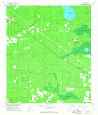
 1956 Sargent1957 Print · USGSThe Florida-Georgia borderlands are captured here in the mid-1950s, highlighting the wild interior where the Southern railroad bisects the great swamps. Trace the isolated outposts of Sargent and Ewing or explore the drainage of White Arm Bay.
 - 1958 Map of Valdosta
 1958 Valdosta1958 Print · USGSSouth Georgia and North Florida are captured here in the mid-fifties, showing the vast Okefenokee Swamp and the vital timber and rail corridors connecting the two states. Researchers can locate the footprint of Moody Air Force Base, trace the Live Oak Perry and Gulf railroad, or find early community sites like Bakers Mill and Paradise Church.
 - 1958 Map of Gainesville
 1958 Gainesville1958 Print · USGSNorth Central Florida’s rail and river networks are frozen in time just before the interstate era. Genealogists and historians can trace the paths of the Atlantic Coast Line through Gainesville or locate coastal settlements like Steinhatchee and Cedar Key.
 - 1959 Map of Valdosta
 1959 Valdosta1959 Print · USGSThe Georgia-Florida borderlands in the mid-fifties reveal a landscape of massive blackwater swamps and emerging military aviation hubs. Genealogists and historians can trace rail-stop towns like Fargo and Stockton or explore the interior reaches of the Okefenokee Swamp and Billys Island.
 - 1959 Map of Gainesville
 1959 Gainesville1959 Print · USGSNorth Florida in the mid-fifties is seen here from the Gulf coast to the inland lakes, showing the rail-and-river network before modern highways dominated. Researchers can trace the paths of the Seaboard Air Line through towns like Chiefland and Micanopy, or explore the coastal inlets of Waccasassa Bay.
 - 1961 Map of Deep Creek, 1962 Print
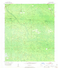
 1961 Deep Creek1962 Print · USGSThe Osceola National Forest in the early sixties was a landscape of timber-driven transport and swampy flatwoods. You can trace the network of an old railroad grade and locate remote sites like Greenfield, a cemetery, and the central Lookout Tower.2 unique versions available
 - 1961 Map of White Springs East, 1963 Print
 1961 White Springs East1963 Print · USGSAlong the Suwannee River in the early sixties, this area shows a rural landscape defined by deep swamps and timber-rich bayous. Genealogists can trace family footprints at Riverside Cem, the settlement of Winfield, and country landmarks like Falling Creek Ch.3 unique versions available
 - 1961 Map of White Springs West, 1963 Print
 1961 White Springs West1963 Print · USGSThe Suwannee River country in the early sixties was a landscape of river-bend memorials and rural church communities. Genealogists can trace family footprints at Springville Ch or Swift Creek Cem, and locate landmarks like the Sailor Hotel and Bullock Lookout Tower.3 unique versions available
 - 1962 Map of High Springs, 1963 Print
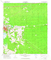
 1962 High Springs1963 Print · USGSHigh Springs and its surrounding rail corridors are captured here in the early sixties, as the region's transportation and agricultural networks were fully matured. Genealogists and local historians can trace rural family landmarks like Traxier Ch, Asberry Cem, and the springs along the Santa Fe River.5 unique versions available
 - 1962 Map of Lake City East, 1964 Print
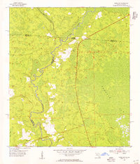
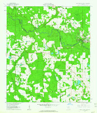
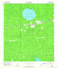
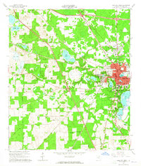
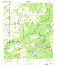
 1962 Lake City East1964 Print · USGSColumbia County is shown here in the early sixties as it balanced forest industry with modern growth. Genealogists and historians can trace old community landmarks from Watertown to the Price Creek Cem and the early campus of Lake City Jr College.3 unique versions available
 - 1962 Map of Mikesville, 1964 Print
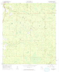
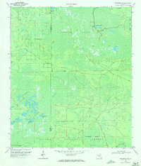
 1962 Mikesville1964 Print · USGSColumbia County in the early sixties was a landscape of quiet crossroads and riverside parks. Researchers can trace family roots through numerous local landmarks like Mikesville Ch, Bland, and the unique Sky Road Inn Airfield.3 unique versions available
 - 1963 Map of Olustee, 1964 Print
 1963 Olustee1964 Print · USGSBaker County at the dawn of the sixties remains a landscape of dense pine woods and significant Civil War heritage. Researchers can trace the rail lines of the Seaboard Air Line or locate family sites near Dyess Cem and the Olustee Battlefield State Mon.3 unique versions available
 - 1963 Map of Ellisville, 1964 Print
 1963 Ellisville1964 Print · USGSNorth-central Florida's rural landscape is captured here in the early sixties, showing a world of small timber-and-farm settlements. Genealogists can trace family roots at Hopeful Cem, Farnell Cem, and the community of Myrtis.2 unique versions available
 - 1963 Map of Columbia, 1965 Print
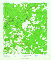
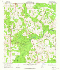
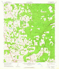
 1963 Columbia1965 Print · USGSMid-century Columbia County is defined by its rural church communities and the north-south corridor of the Atlantic Coast Line. Genealogists and local historians can locate many family-named landmarks including Mt Salem Ch, Bethel Ch, and Pine Rose Ch.2 unique versions available
 - 1963 Map of Lake City West, 1965 Print
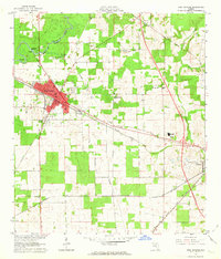
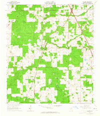
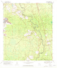
 1963 Lake City West1965 Print · USGSLake City and the surrounding Columbia County landscape are shown in the early sixties as a vital railroad junction. Genealogists and historians can trace family locations near Mount Carmel Cemetery, Five Points School, or the Richardson High School campus.2 unique versions available
 - 1966 Map of Lulu, 1967 Print
 1966 Lulu1967 Print · USGSFlorida's interior timberlands come into focus in the mid-1960s, showing the rural rail corridor between Lulu and Cliftonville. Genealogists can locate Gillen-Allen Cem, Oak Grove Ch, and the isolated turpentine site at Shaws Still near Swift Creek.2 unique versions available
 - 1967 Map of Sargent, 1968 Print
 1967 Sargent1968 Print · USGSThe Georgia-Florida borderlands come alive in this late-sixties experimental survey, where the great southern swamps meet the rail line. Researchers can trace the Southern railroad through the Okefenokee Swamp past Sargent and Moorehead.
 - 1968 Map of Hildreth, 1971 Print
 1968 Hildreth1971 Print · USGSThe rural river junction where the Suwannee River meets the Santa Fe River is captured here during the late sixties. Researchers can find long-standing community sites such as Santa Fe Cem Ch and the springhead at Ichetucknee Springs.4 unique versions available
 - 1969 Map of Wellborn, 1971 Print
 1969 Wellborn1971 Print · USGSThe Suwannee County countryside comes into focus during the late sixties, centered on the railroad town of Wellborn. Researchers can trace rural lineages through family landmarks like McClellan Cem and isolated country churches such as Mt Beulah Ch.
 - 1969 Map of Sanderson NW, 1971 Print
 1969 Sanderson NW1971 Print · USGSUpper Baker County in the late sixties remains a wilderness of vast wetlands and timber tracks within the Osceola National Forest. Outdoorsmen and researchers can trace the old routes of Sand Hill Road and find isolated landmarks like Negro Camp Island and Buck Island Lake.3 unique versions available
 - 1969 Map of Benton, 1971 Print
 1969 Benton1971 Print · USGSThe Hamilton and Columbia county borderlands along the Suwannee River are captured here in the late sixties. Local researchers can trace old routes like Eightmile Still Road, locate the Prospect Ch, and find the rural settlement of Benton.3 unique versions available
Showing maps 1-25 of 164
Top cities of Columbia County
Frequently asked questions
- What are the different types of historical maps available for Columbia County?
- What is the oldest map of Columbia County?
- Where can I purchase historical maps of Columbia County for my home or office?
- Where can I download high-res historical maps of Columbia County?
- Are there historical topographic maps available for Columbia County?
- Is there historical aerial imagery available for Columbia County?
- Where are historical maps of Columbia County sourced from?