
1961 Map of Deep Creek
USGS Topo · Published 1962About this map
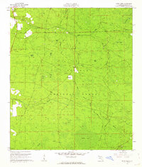
The Osceola National Forest dominates this section of Columbia County, Florida, where a landscape of wetlands and pine flatwoods is defined by its water systems. In the early 1960s, the area's timber history is visible through an extensive network of jeep trails and remnants of an old railroad grade that once facilitated the local logging industry. The small settlement of Greenfield sits near the center, marked by a nearby Lookout Tower used for fire detection across the expansive cypress bays. Water flows south toward the Suwannee River through several major drainage systems, including Deep Creek, Falling Creek, and Sandy Drain. The map documents numerous swampy basins known locally as bays, such as Turtle Bay, Otter Bay, and Logging Bay, illustrating the wet, low-lying character of this northern Florida terrain. For genealogists, the survey records a remote cemetery and Church Pond, providing specific points of interest in an otherwise sparsely populated forest.
Find a feature on this map
34 named features on this map. Tap any name to fly to it.
Don’t see what you’re looking for? This feature index may not catch every label — zoom into the map to look around manually.
Map Details
Editions of this 1961 Deep Creek Map
2 editions found
Other maps of this area

1954 · Valdosta
USGS Topo · 1:250,000

1958 · Valdosta
USGS Topo · 1:250,000

1959 · Valdosta
USGS Topo · 1:250,000

1961 · White Springs East
USGS Topo · 1:24,000

1962 · Lake City East
USGS Topo · 1:24,000

1963 · Olustee
USGS Topo · 1:24,000

1963 · Lake City West
USGS Topo · 1:24,000

1969 · Sanderson NW
USGS Topo · 1:24,000
1969 · Benton
USGS Topo · 1:24,000
1969 · Fairview
USGS Topo · 1:24,000